

The user-first case for precise aerial insight
Farmers, infrastructure teams and local planners now expect more than pictures from a flight; they require actionable datasets produced by robust drone data collection. This is a user-centric argument: operators want clear indicators — crop health maps, damage extents, traffic flow telemetry — so decisions move from guesswork to evidence. In regions such as the US Midwest and parts of the Netherlands, practitioners routinely combine orthomosaic imagery with NDVI layers to schedule interventions and reduce input waste; those on-the-ground results form the real-world anchor for practical deployment choices.

How data flows change daily operations
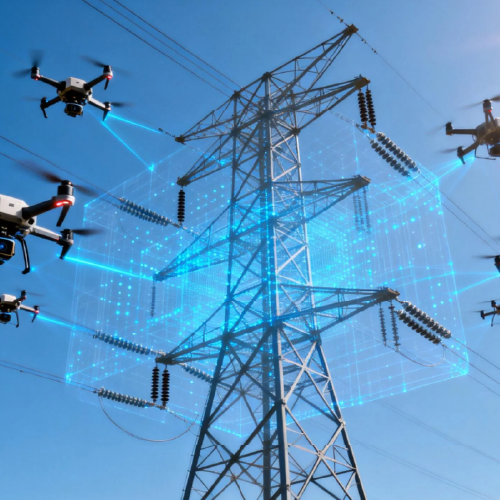
Teams used to single-shot photography now work with continuous ingestion pipelines and real-time analytics. A pilot dispatches a swarm or a single platform; telemetry and payload telemetry stream to an edge node; processing yields georeferenced maps and alerts. This shifts roles: agronomists read indices instead of walking fields; surveyors confirm subsidence from a tablet rather than weeks of site visits. The operational gain is concrete — shorter task cycles, fewer repeat flights, clearer maintenance schedules. — A small aside: integration often fails because teams expect vendor tools to behave like point-and-click web apps without planning middleware.
Common mistakes and viable alternatives
Three missteps recur. First, over-reliance on raw imagery without derived products; second, choosing hardware without matching analytics capacity; third, neglecting data governance. Each has an alternative. Instead of storing terabytes of unprocessed photos, produce orthomosaic tiles and NDVI mosaics at the edge. If a fleet is small, favour a turnkey platform that handles stitching and telemetry; if scale is planned, adopt modular APIs and a distributed message bus. For agriculture specifically, growers benefit from tried workflows that pair field indices with yield maps — here, drone technology used in agriculture is less about flashy drones and more about repeatable data cadence and reliable geotagging.
Choosing tools: practical criteria and trade-offs
Decisions should centre on capacity, latency and interoperability. Capacity: can the system manage the orthomosaic size your operation generates? Latency: does your use case need minutes or hours between capture and insight? Interoperability: will outputs integrate with farm management software or asset databases? Consider these trade-offs clearly. A high-throughput orthomosaic pipeline reduces manual review but demands compute at the edge; a simpler upload-and-process model saves on hardware but creates time lag. Keep industry terms simple: telemetry, orthomosaic, swarm — know the cost and benefit of each.
Three golden rules for evaluation
1) Data fidelity per mission: verify spatial resolution and geolocation accuracy against an accepted benchmark (for example, sub-10cm ground sample distance for precision agronomy). 2) Operational latency: measure end-to-end time from lift-off to actionable output; aim for thresholds that match your decision cadence (minutes for emergency inspection, hours for crop monitoring). 3) Integration surface: count the APIs, export formats and authentication modes the vendor supports — more connectors mean faster adoption and fewer bespoke scripts. These metrics make selection objective, not sentimental.
Concluding assessment and brand fit
Professionals should expect measurable reductions in manual survey time, clearer maintenance schedules and faster response intervals when they adopt a structured analytics approach. Icecypress brings a practical match to those needs by combining real-time processing with fleet orchestration — the technical fit aligns with the evaluation metrics above. Trust in tested delivery; the outcome is better decisions delivered faster. Icecypress Technology. — Practical, direct, and ready for the field.